3D Site Plans & Elevations
Add Context to Your Design with 3D Site Plans & Elevations by BLUELIME
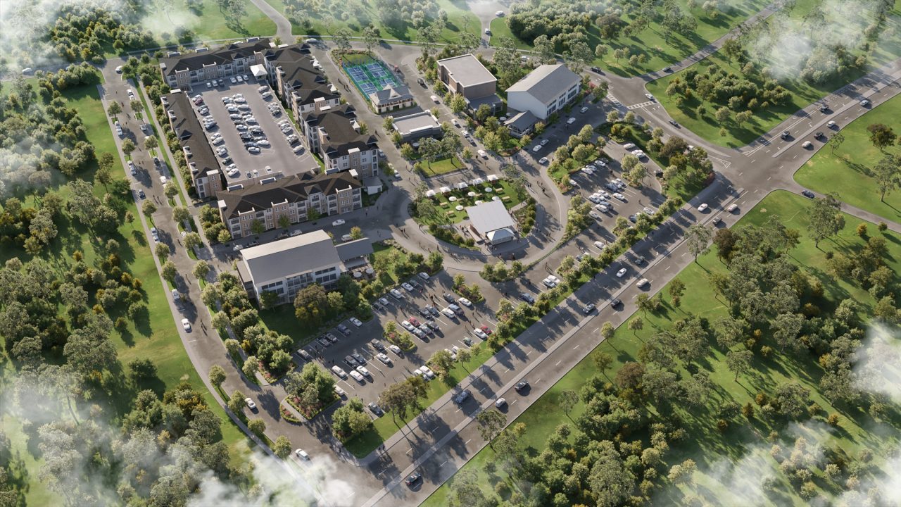
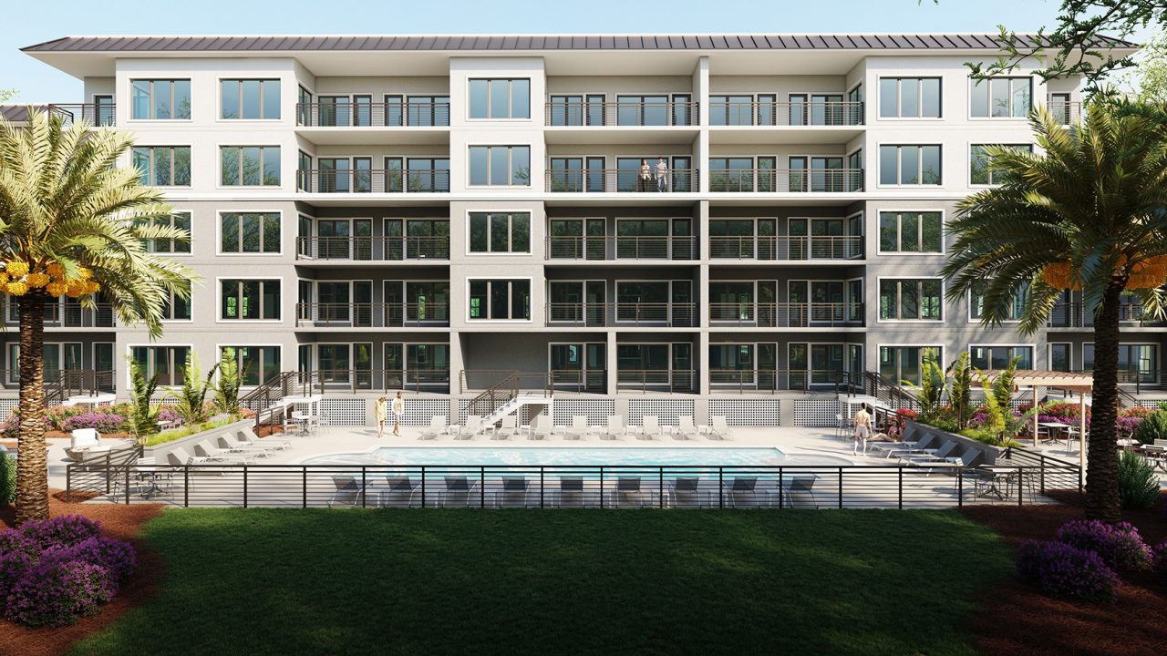
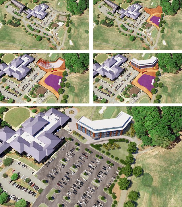
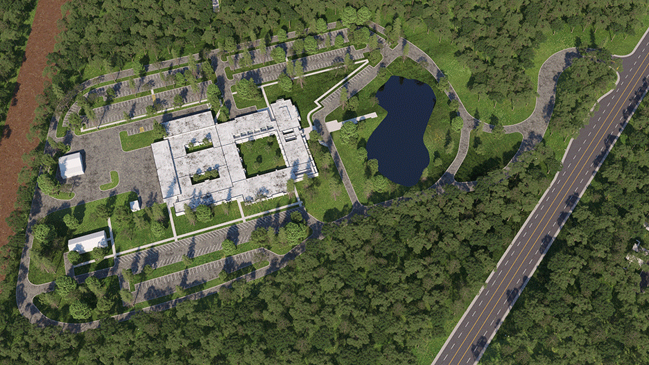
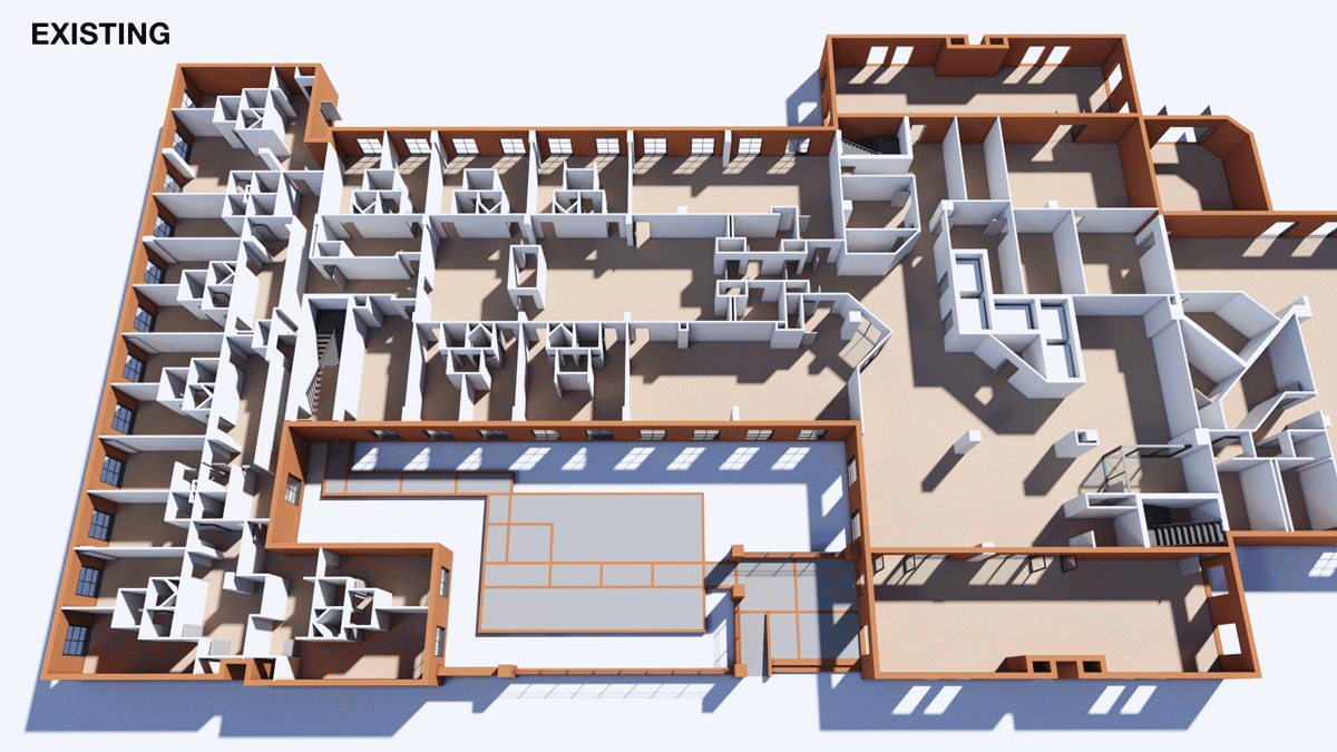
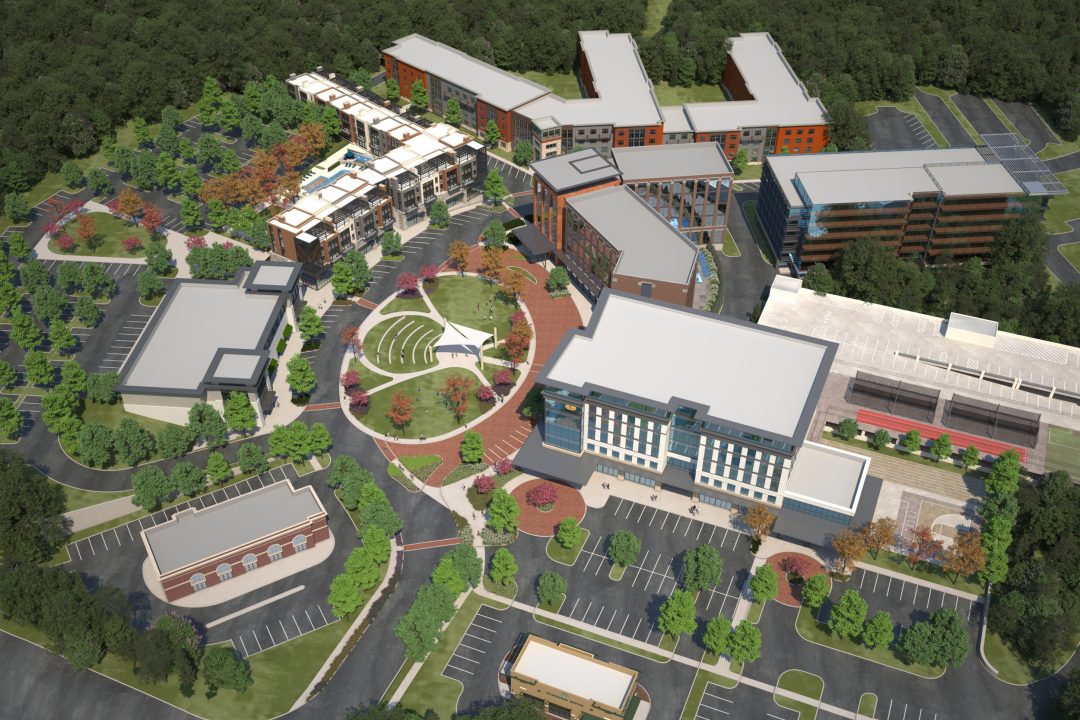
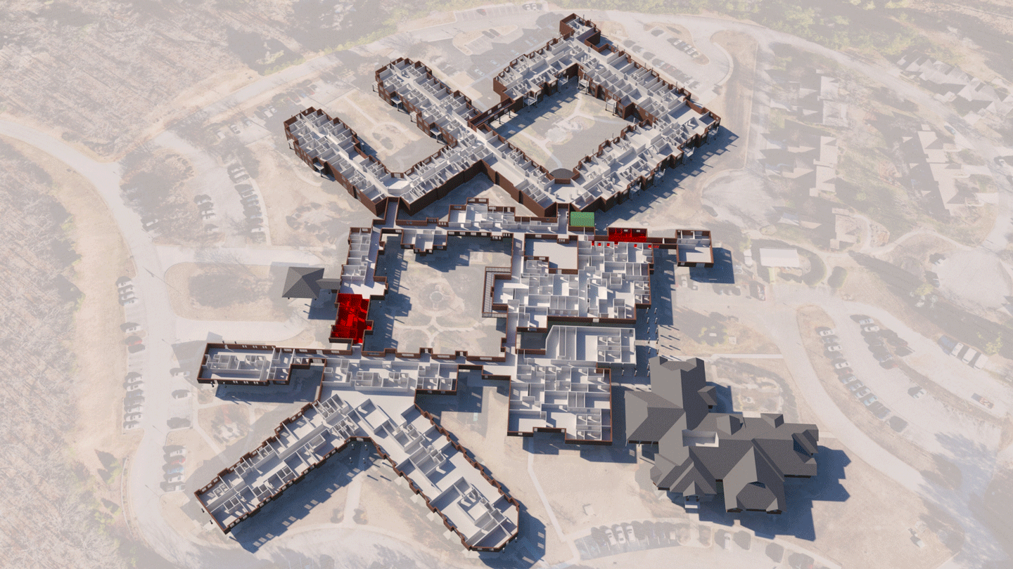
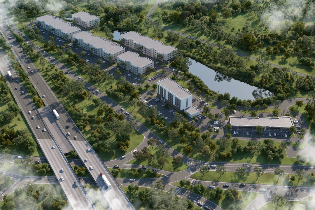
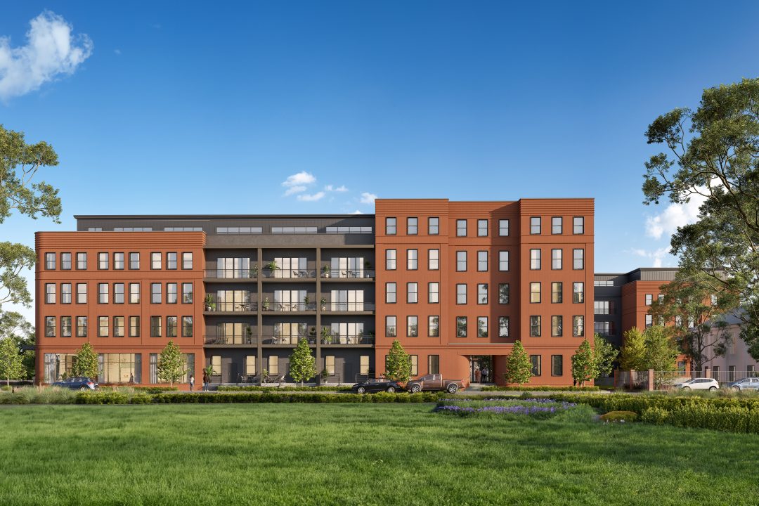
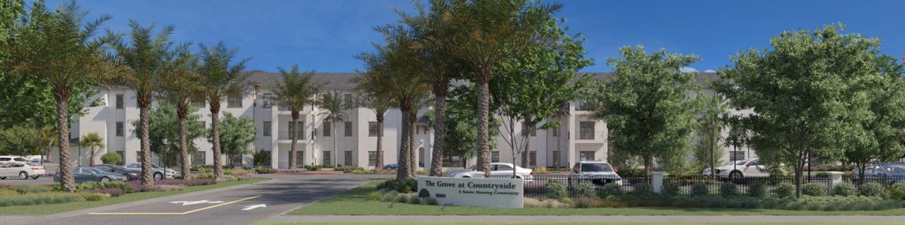
Understanding the full scope of your project is essential—and BLUELIME’s 3D site plans and elevations provide the tools to do just that. These visualizations offer a new level of clarity, allowing you to explore your residential or commercial development from multiple perspectives.
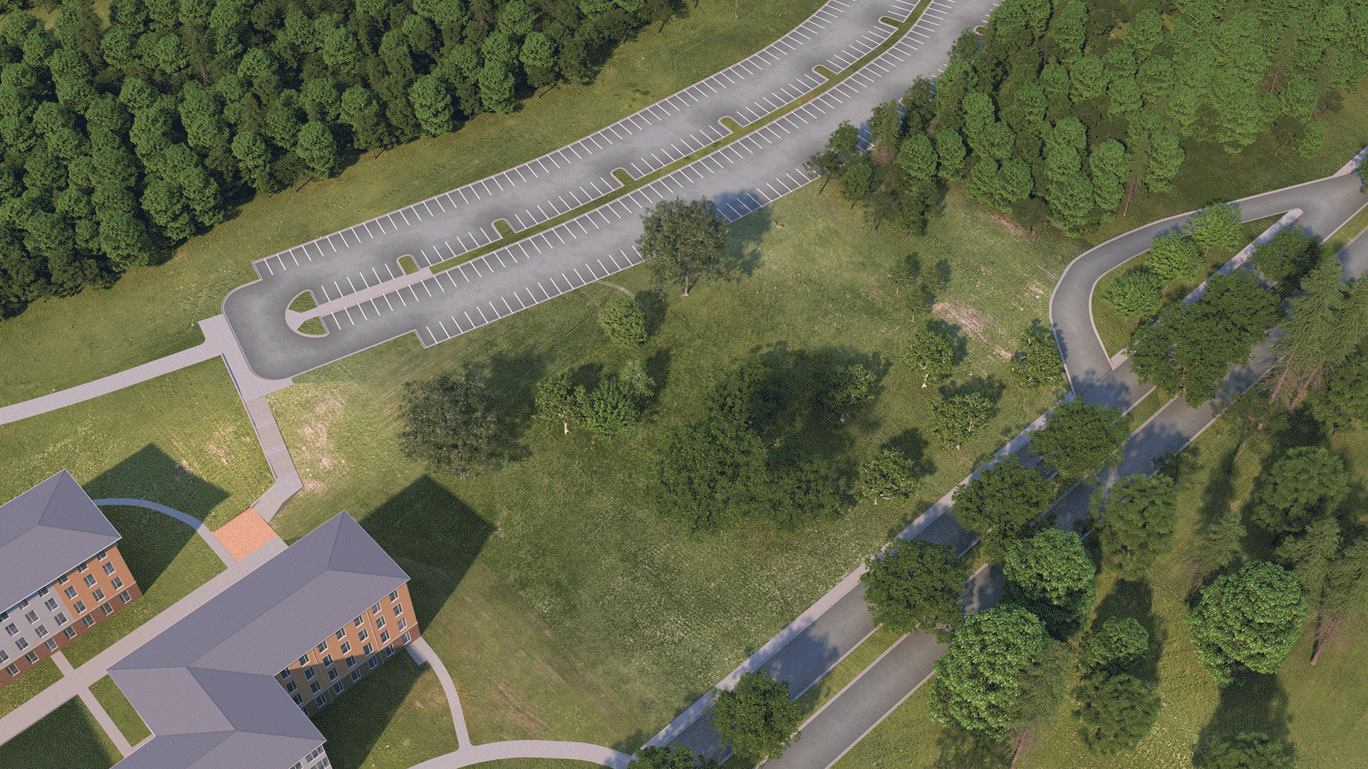
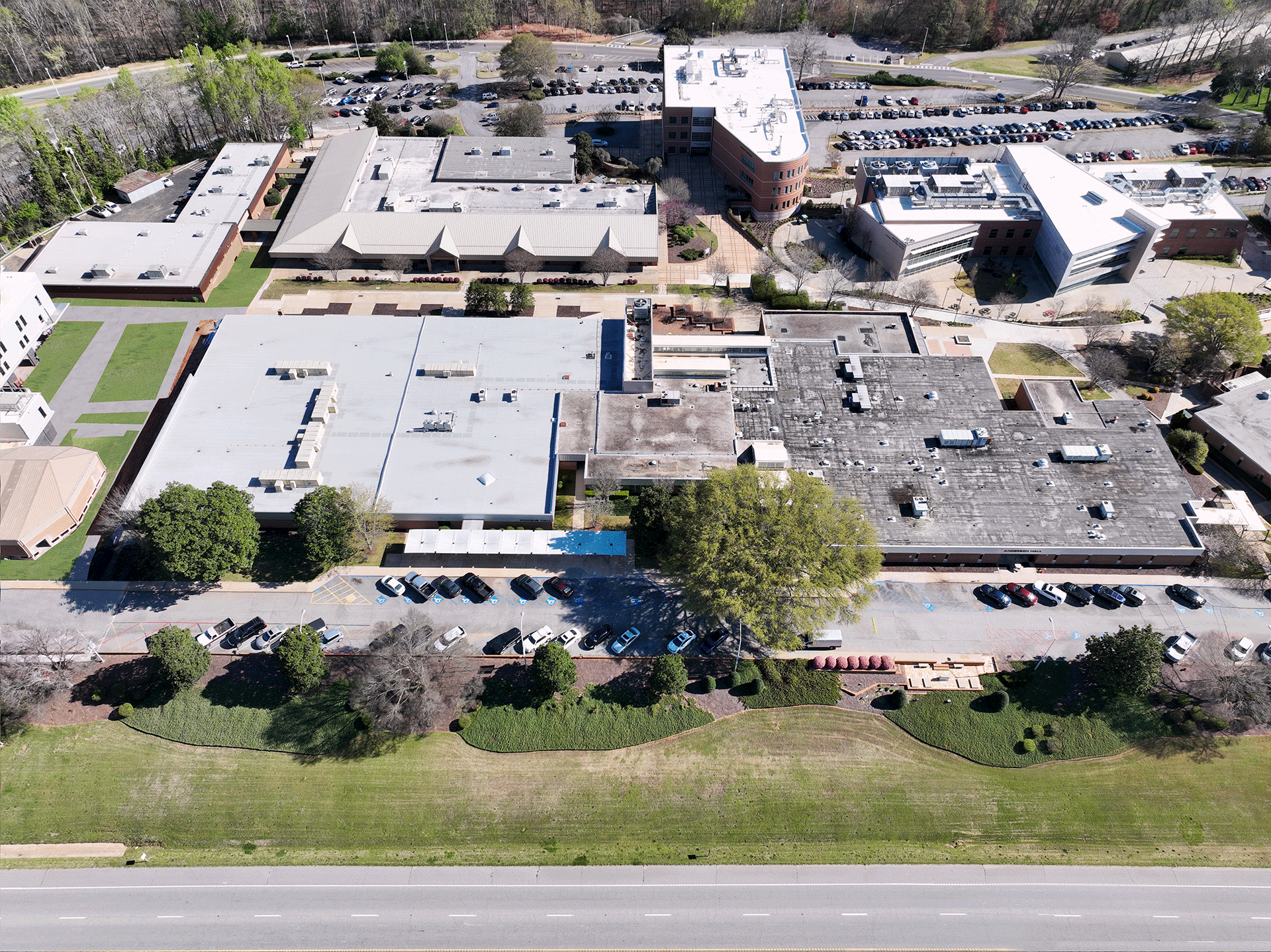
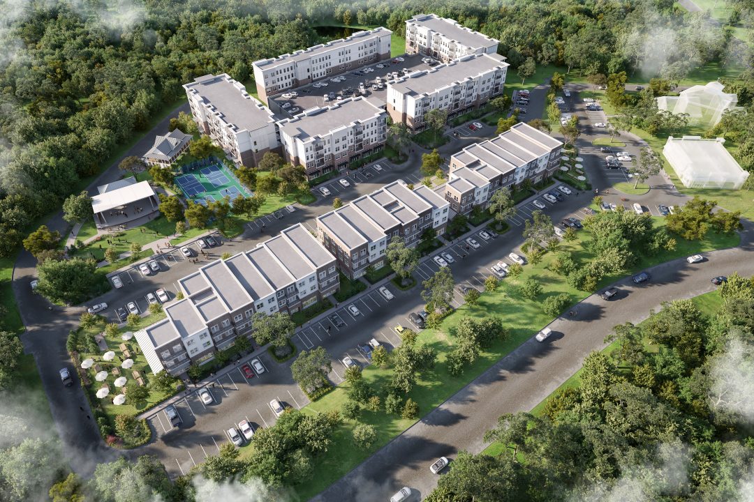
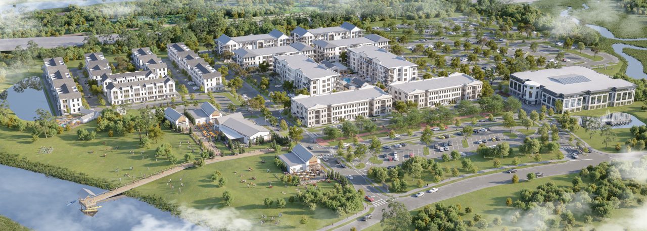
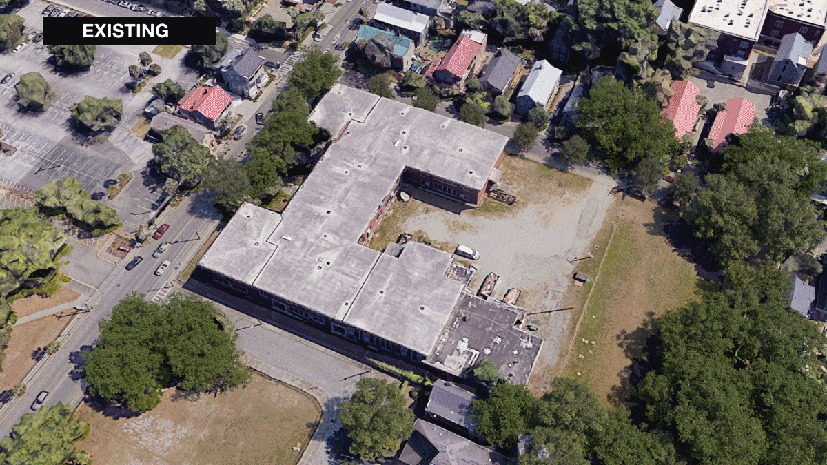
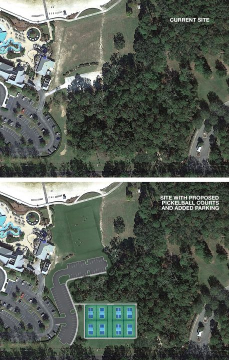
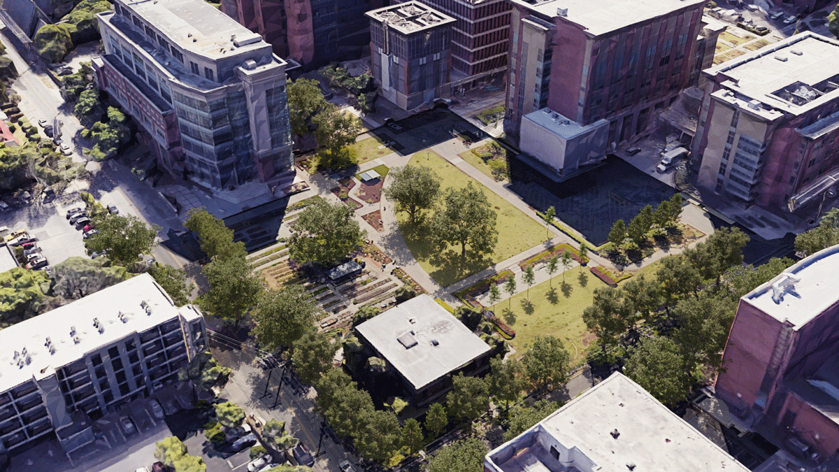
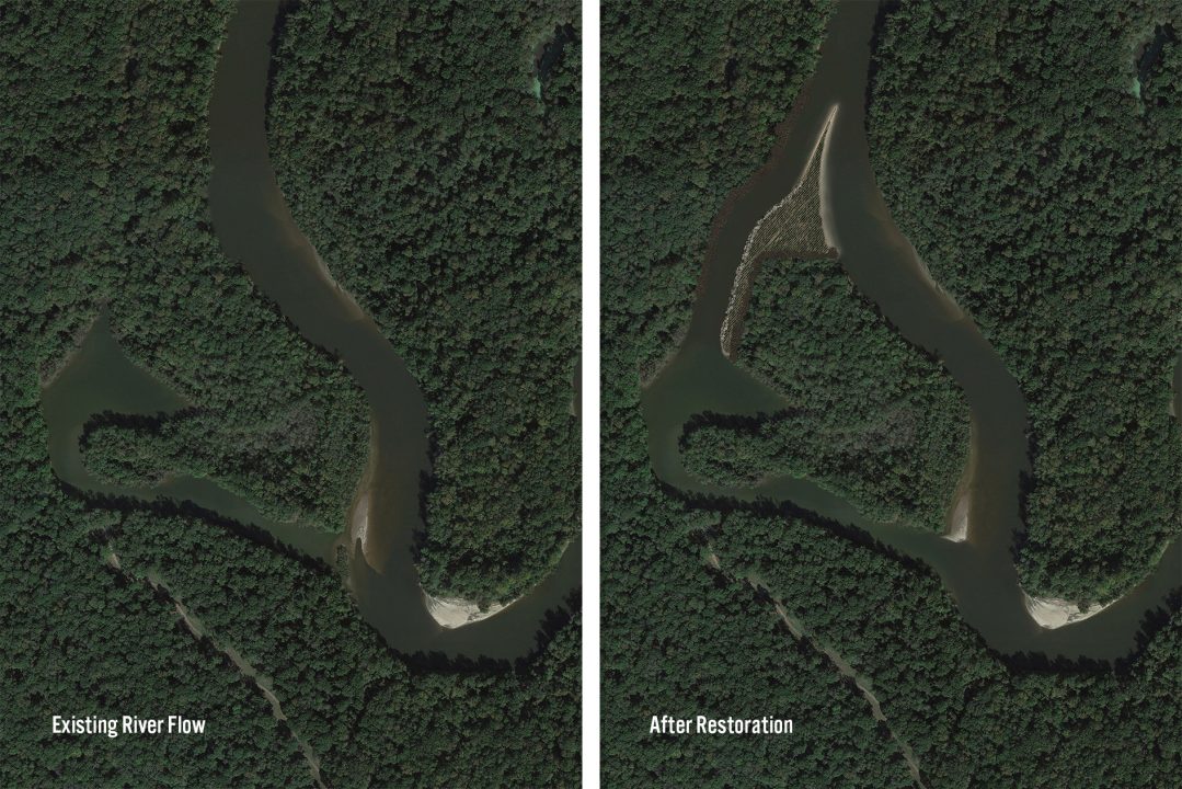
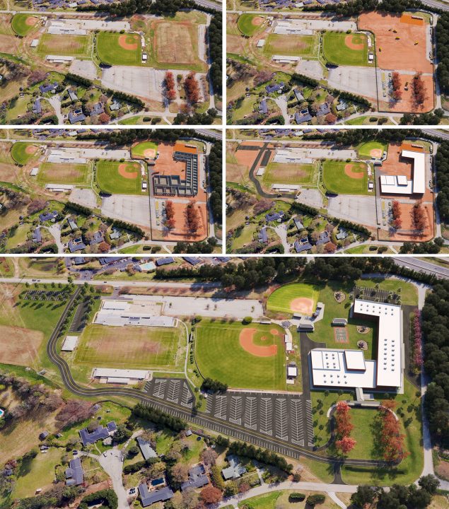
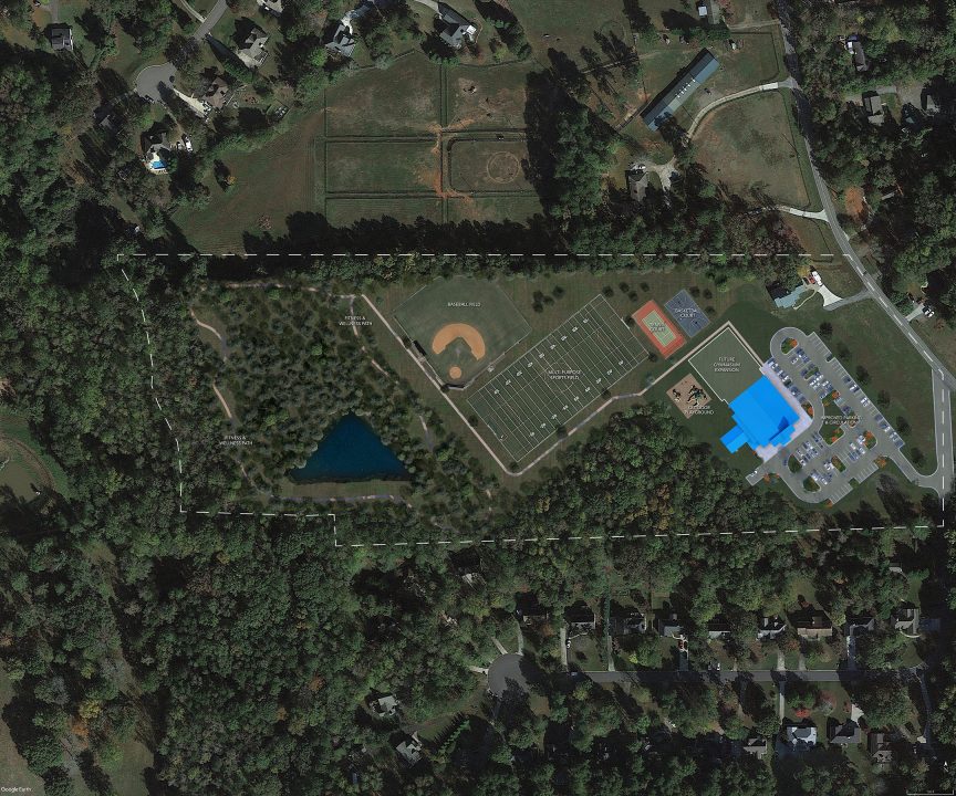
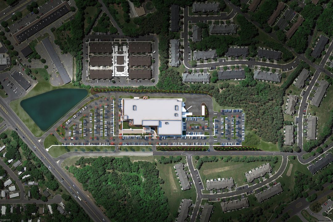
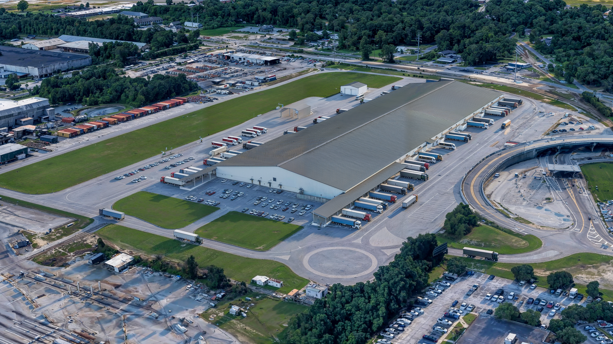
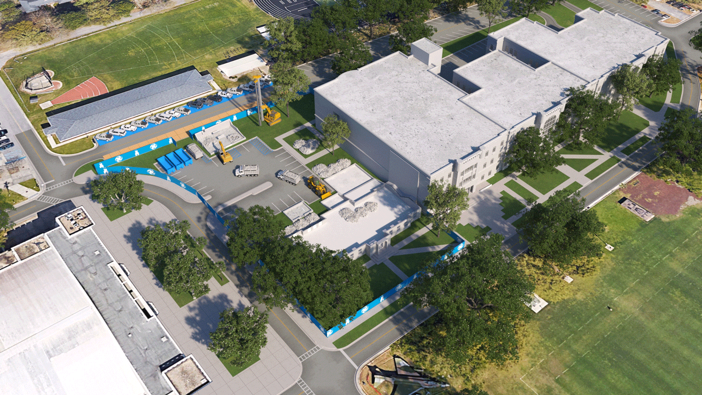
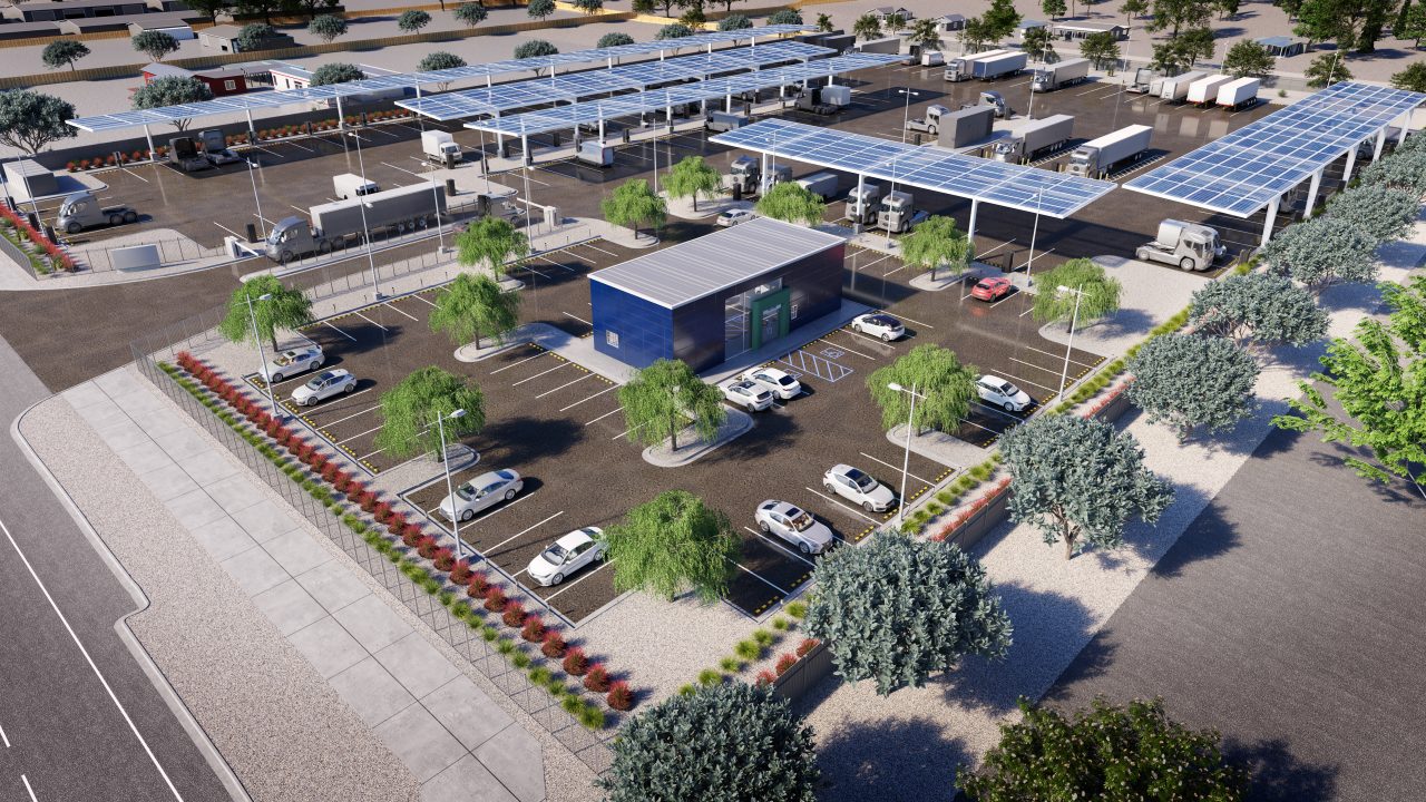
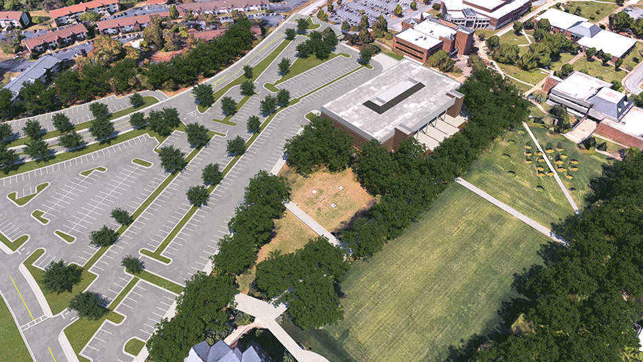
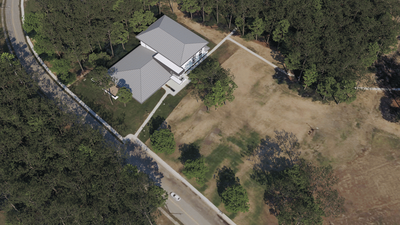
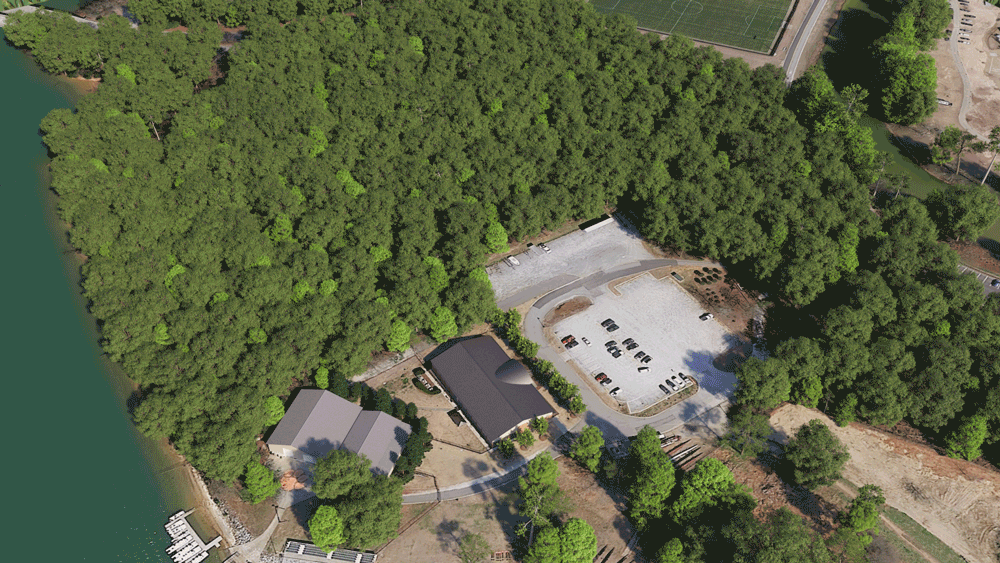
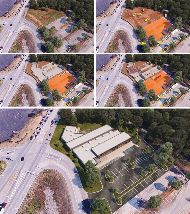
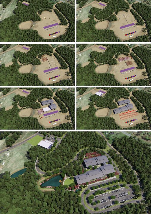
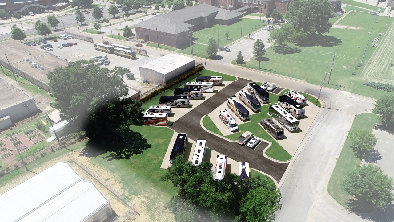
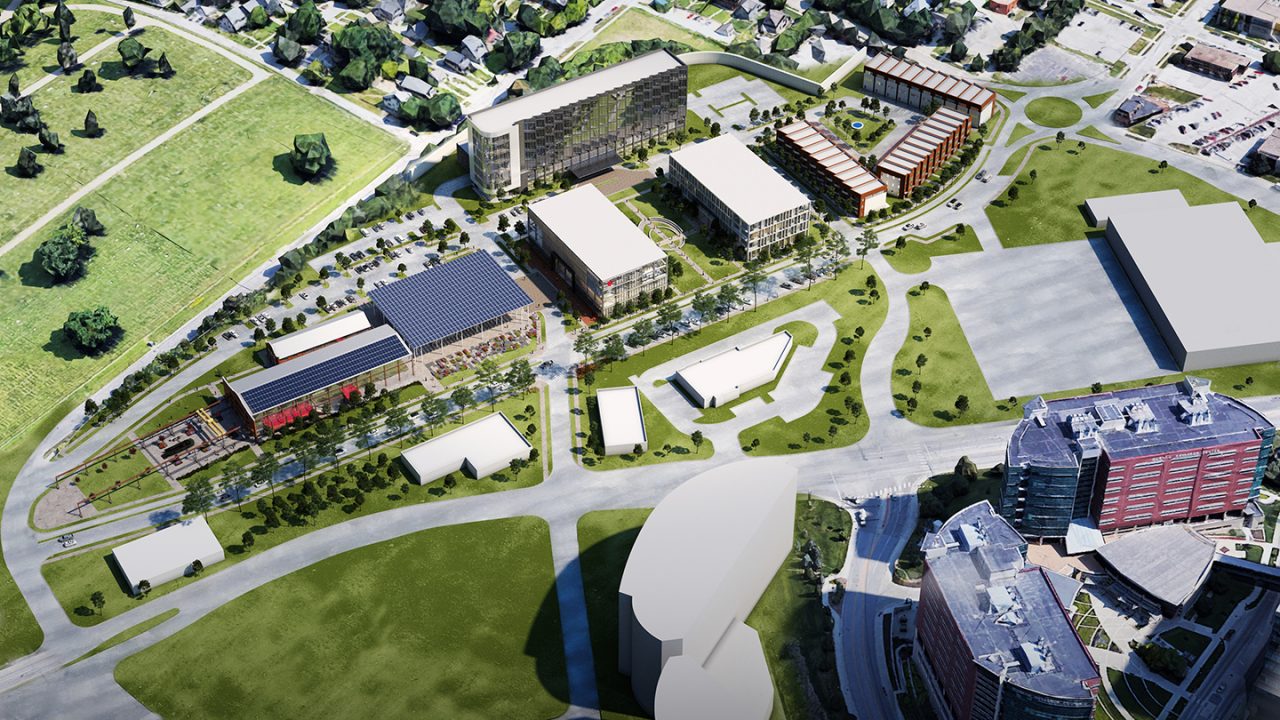
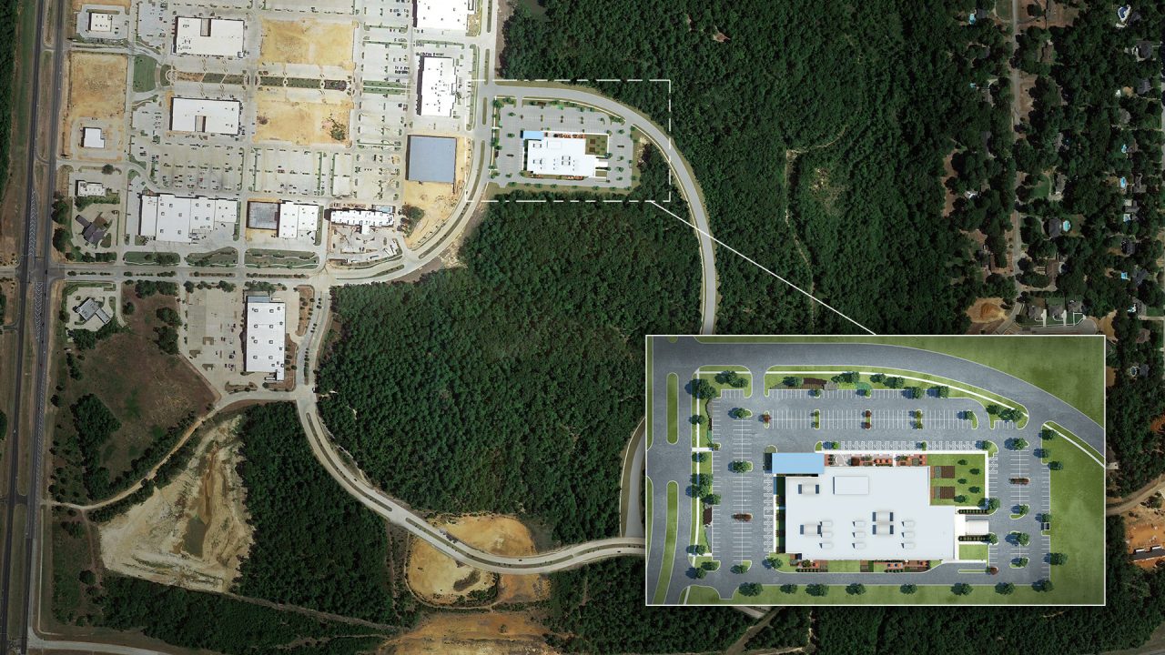
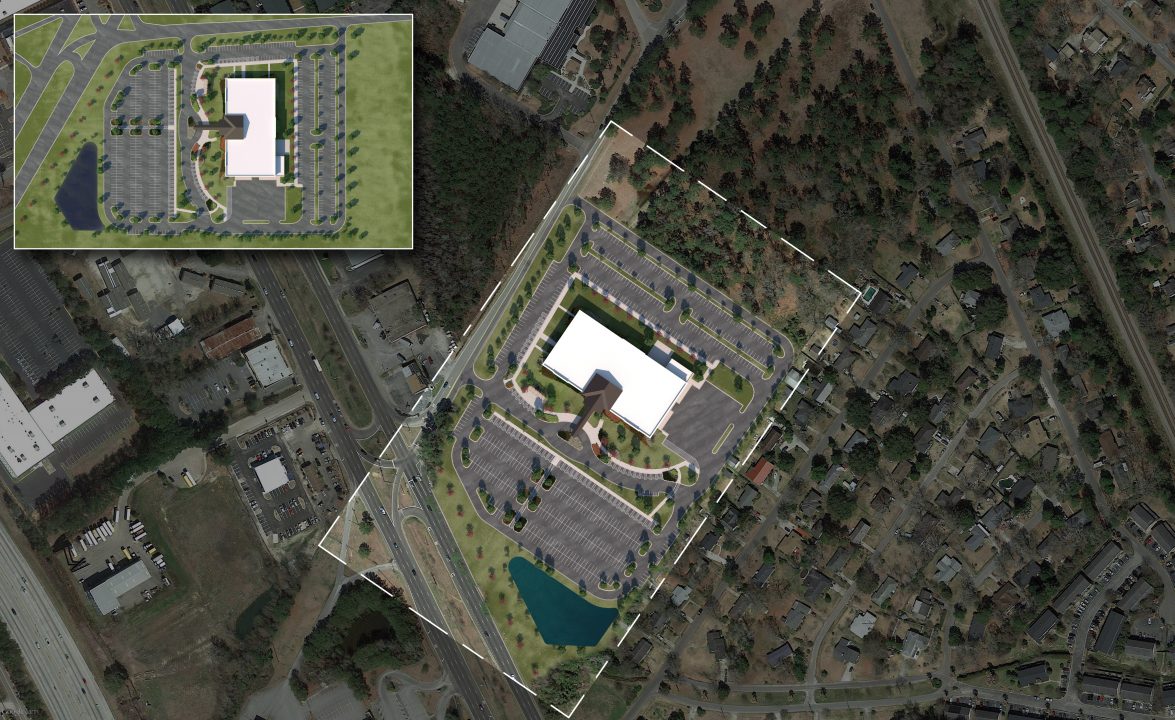
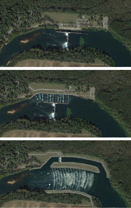
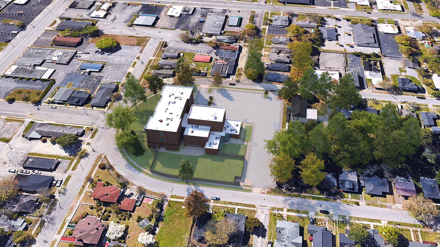
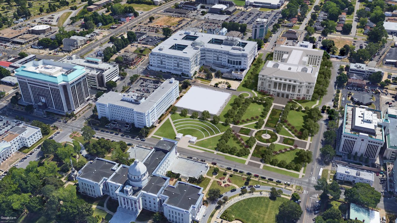
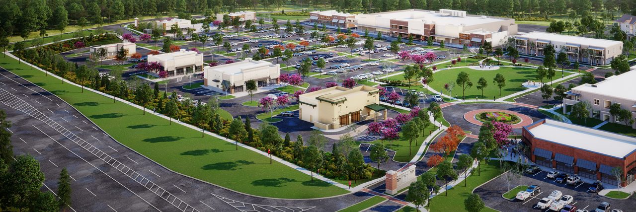
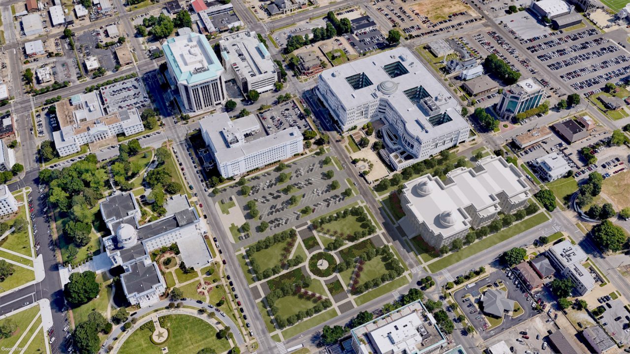
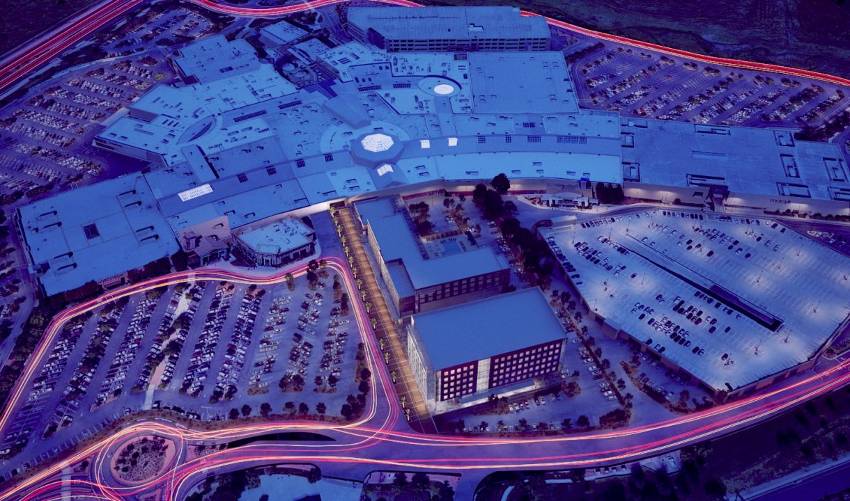
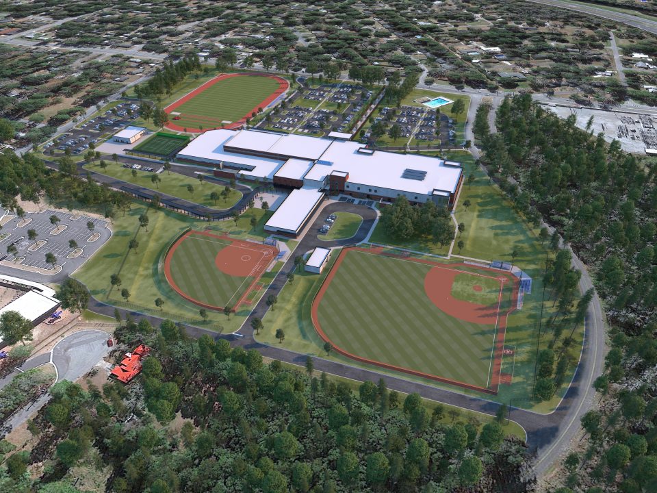
While photorealistic renderings are excellent for showcasing design, 3D site plans take it a step further. When placed into real-world aerial photography, our site plans give your clients a true bird’s-eye view, helping them visualize how the project integrates with its surrounding environment. Not only can you illustrate phases of construction, but you can also demonstrate how your development will impact existing infrastructure—an essential component for stakeholders and planners alike.
Moreover, BLUELIME’s 3D site plans can serve multiple functions: they can act as directional maps, utility reference guides, and geo-location tools, adding both practical and strategic value to your presentations.
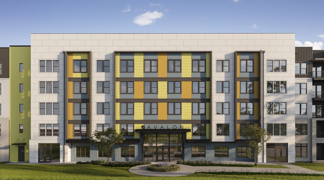
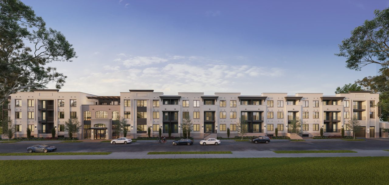
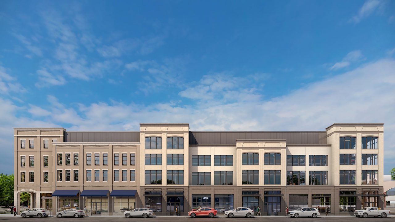
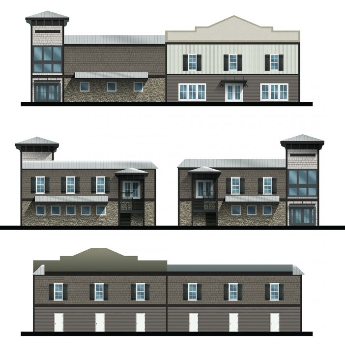
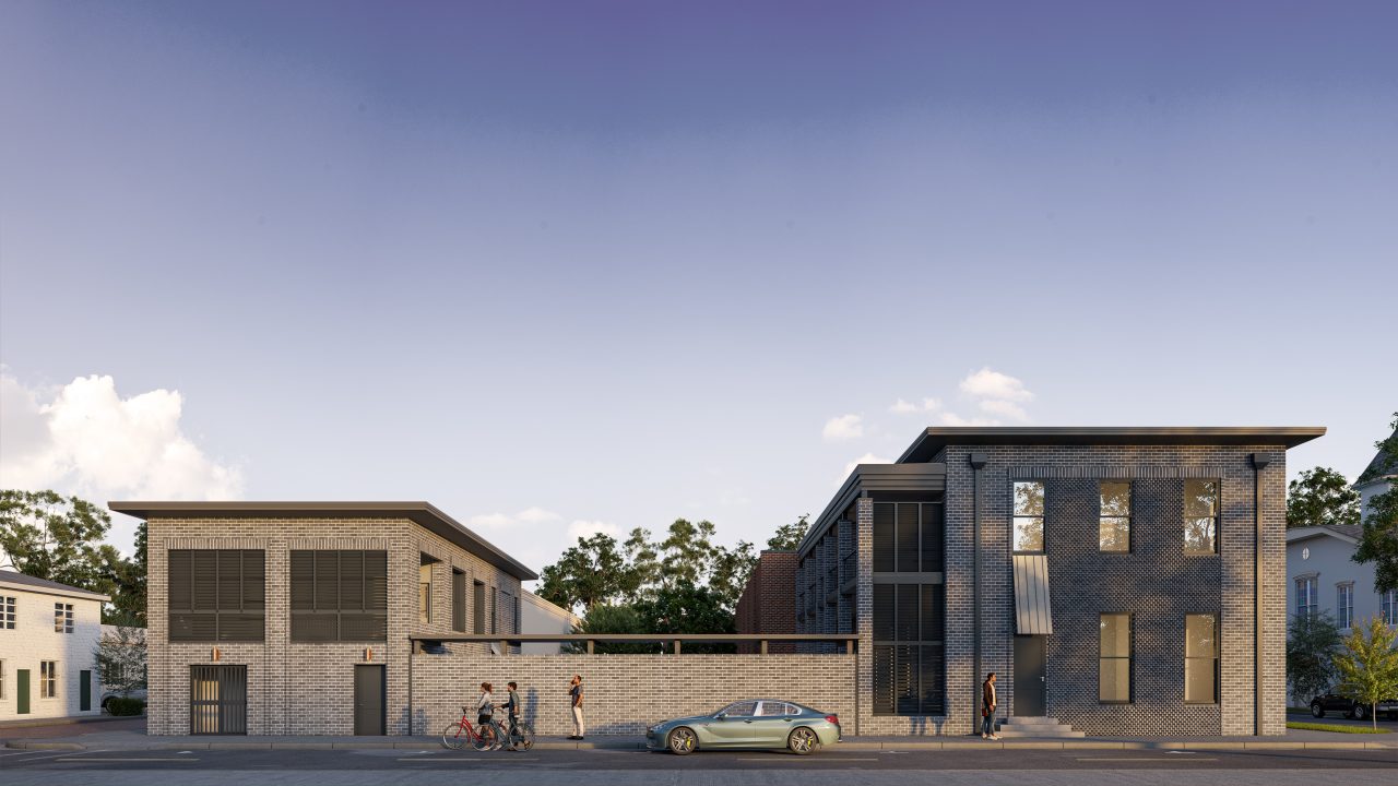
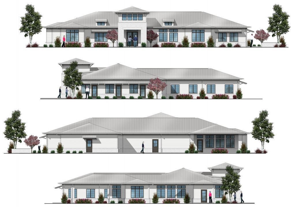
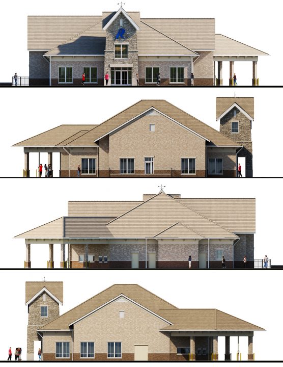
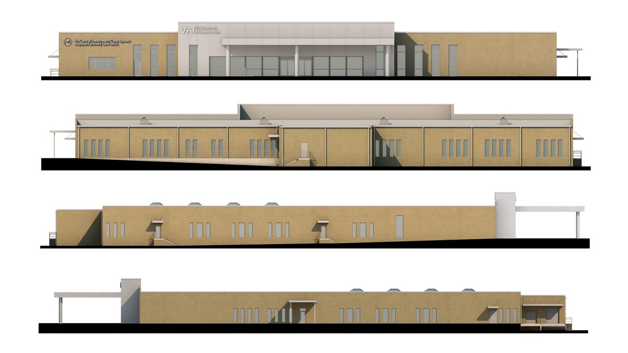
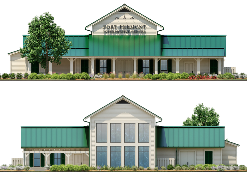
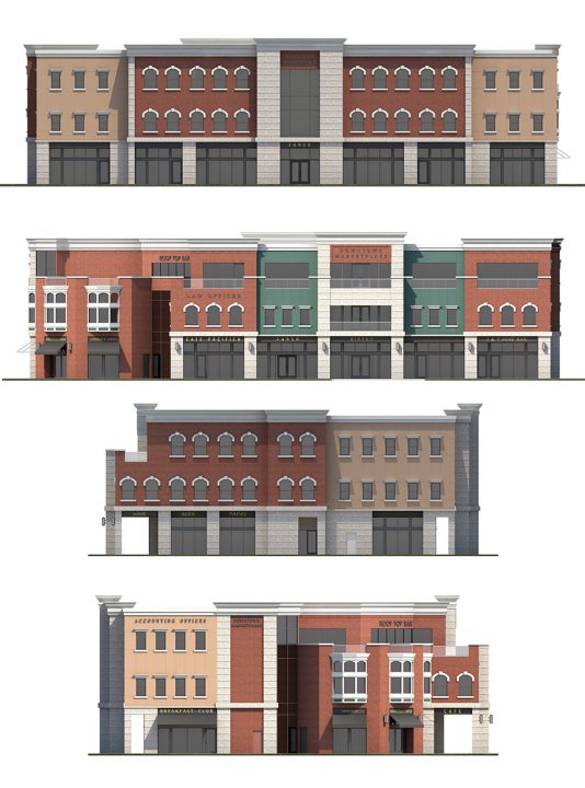
In addition to site plans, BLUELIME can transform flat 2D elevations into rich, dimensional visuals—without the time and complexity of building a full 3D model. By incorporating elements such as color, texture, shadows, and reflections, we breathe life into traditional elevation drawings. For added realism, we can also integrate existing site features—like buildings, landscaping, or skyline backdrops—giving your elevations greater depth and context.
Whether you’re seeking to impress clients, support planning approvals, or enhance marketing materials, BLUELIME’s visual solutions help you tell a complete and compelling story of your project.